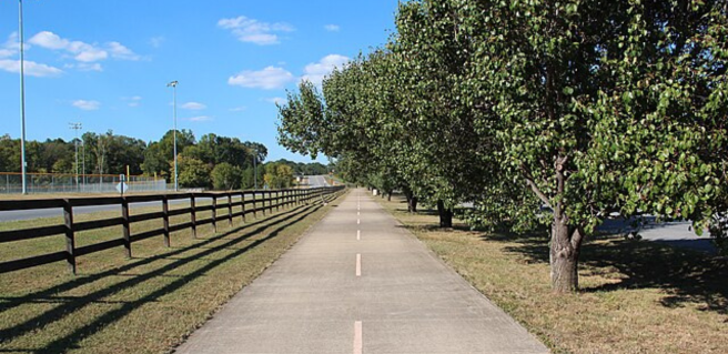
One of the more unique and historical destinations that is perfect for runners, walkers, bikers, horses and general sight-seers is the Silver Comet Trail, a paved, multi-use recreational trail that runs throughout the west metro Atlanta area.
The Silver Comet Trail travels west from Cobb County for 61.5 miles through Paulding and Polk counties until it reaches the Alabama state line. Here, the Silver Comet Trail joins the 33-mile-long Chief Ladiga Trail. Together, these trails make up the longest paved trail in America at 94.5 miles.
The Silver Comet Trail is a rail trail, meaning it was constructed along abandoned railroad lines, and it was named after the Silver Comet passenger train that was introduced by Seaboard Air Line Railroad in 1947 during the height of rail travel. The original rail line ran from 1897 until 1903, and passenger service was available from 1947 through 1969. The rail line was eventually abandoned in 1989.
The Silver Comet Trail begins at the Mavell Road Trailhead in Smyrna just over a mile west of the intersection at South Cobb Drive and the East-West Connector. Here at mile marker 0, trail users will find restrooms, parking, picnic tables, water, an emergency phone, dog waste bags and a small lecture platform.
There are many trailheads located along the Silver Comet Trail. Some of the more interesting or significant trailheads include:
- Floyd Road Trailhead: Located at mile marker 4.2 in Cobb County, there is a convenience store, restrooms, a Silver Comet Fountain Park that was donated by David Weekly Homes and SCD Cycles. Located in the restored Silver Comet Depot, SCD Cycles rents, sells and repairs bikes.
- Hiram Trailhead: This Paulding County trailhead, located at mile marker 14.7, is next to Homer Leggett Park. Trail users will find restrooms, water, covered picnic tables and a children’s playground at this resting point, as well as an original train caboose that serves as the Sherriff’s station for the local deputies that patrol the trail.
- Rockmart Trailhead: Here at mile marker 37.6, the Silver Comet Trail merges into Riverwalk Park, which travels through downtown Rockmart. The trail also passes next to the Rockmart Slate Corporation, which opened in the 1850s. Historic Rockmart is home to interesting buildings, history and shops, and there are many unique places to sightsee, eat and visit along this section of the trail.
- Grady Road Trailhead: At mile marker 45.8, trail users will be confronted with Surprise Hill, which is taller than it looks from the trailhead. As you head west along the trail from this point, the rolling hills continue and the trail becomes more challenging as it leaves the original rail bed.
- Cedartown Trailhead: Here, visitors will find the Cedartown Depot, which was restored in 2004. Located at mile marker 51.4, this replica of the original Seaboard Airline Depot serves as the Cedartown Welcome Center and the Silver Comet Museum.
There are also many historical or interesting places located along the Silver Comet Trail ranging from unique rock formations to wetlands and old train trestles.
- Heritage Park: This 105-acre nature preserve in Smyrna features a soft-surface walking trail that runs along an elevated boardwalk over wetlands and travels through forests along Nickajack Creek. The trail also passes the ruins of the Concord Woolen Mills and is just a short distance from the historic Concord Covered Bridge.
- Wildhorse Creek and Lucille Creek trails: These trails are part of a one-of-a-kind trail system that is being created by the City of Powder Springs to connect major areas, including individual communities, recreational areas and historic downtown. Lucille Creek Trail is located just east of the Florence Road Trailhead, and the Wildhorse Creek Trail is a two-mile paved spur that starts at the Carter Road Trailhead. The Wildhorse Creek trail is a wooded trail that runs along both Wildhorse and Noses creeks and has an observation tower that overlooks the wetlands.
- Pumpkinvine Trestle: Located less than one mile west of the Rambo Road Trailhead, which is at mile marker 22.2 in Dallas, this trestle was built in 1901 and is more than 750 feet long. Rising 126 feet above Pumpkinvine Creek, the bridge was restored in 1999 and opened for trail users in 2000. The trestle leads into one of the most remote areas of the trail, which winds through the more than 25,000-acre Paulding Wildlife Management Area.
- Coot’s Lake Beach: This public swimming location is located next to the Coot’s Lake Trailhead at mile marker 33.5. Heading west from this location, the trail has gorgeous scenery and impressive rock formations.
- Brushy Mountain Road railroad tunnel: Less than three miles east of Coot’s Lake Beach at mile marker 30.9 is this 800-foot, turn-of-the-century railroad tunnel that was built in 1912.
- Nathan Dean Sports Complex: Located at mile marker 38.7, this park has restrooms, picnic tables, playgrounds, pavilions and a wide variety of youth sports fields.
- State Line Greenway Park: This park is just west of the Esom Hill Trailhead, and its arches and picnic tables are positioned to highlight the state line between Georgia and Alabama. At this point, the Chief Ladiga Trail begins and heads into the Talladega National Forest.
The Silver Comet Trail is free of charge and is wheelchair accessible. To find out more information about the Silver Comet Trail or see trail maps, click here.