Whether you’re looking to have an outdoor adventure in your own backyard or want a weekend getaway where you can be at one with nature, we guarantee you’ll love this Guide to Georgia Trails. July is National Parks and Recreation month, and what better way to celebrate than by exploring some of Georgia’s most popular trails.
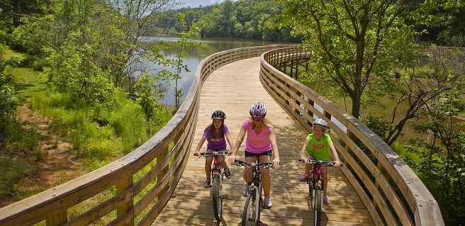
One of Georgia’s most popular trails, the Silver Comet Trail, is located just northwest of Atlanta. Spanning 61.5 miles, the Silver Comet begins at the Mavell Road Trailhead in Smyrna and crosses through Cobb, Paulding and Polk counties to the Georgia/Alabama state line near Cedartown at the Esom Hill Trailhead. Continue on into Alabama and the trail connects to the 33-mile long Chief Ladiga Trail. Both trails are fully paved routes built on abandoned railroad lines that are perfect for walking, hiking, biking, rollerblading, horseback riding, dog walking and more.
Brasstown Bald Trail is perhaps one of the shortest yet steepest trails in Georgia. The summit of the mountain is Georgia’s tallest reaching a height of 4,784 feet above sea level. The hike is moderate in difficulty with the steep climb, but the short distance and paved trail make the journey a little less intense. The trek to the top winds through the forest, but the summit is bare with small plants and rocks, giving the top a 360 degree view.
The Appalachian Trail, which begins at Springer Mountain here in Fannin County and ends at Mount Katahdin in Maine, spans an impressive 2,200 miles and is part of the Triple Crown of long distance hiking. The Georgia portion of the trail continues for 79 miles from Springer to Bly Gap, and reaches its highest point of just over 4,400 feet at Blood Mountain. Hikers can access the trail from many points that lead to different mountains and gaps, but no matter which path you follow, you are guaranteed scenic views of North Georgia.
Tallulah Gorge Sliding Rock Trails is a favorite in Georgia because of the towering walls and waterfalls. The trail is 3.4 miles long and features gorgeous views from the gorge’s rim before it plummets to the gorge floor by a swinging suspension bridge. Once the ridge is climbed, the hike takes yet another plunge over rocks and boulders to see the Bridal Veil Falls waterfall. This is an advanced hike and requires a free permit from the ranger’s office but the scenery is worth it!
Beginning at Anna Ruby Falls is the 4.6 mile Smith Creek trail in Helen. Traveling over Hickory Nut Ridge and Smith Mountain to Unicoi State Park, this U.S. Forest Service trail is known for its beautiful waterfall and moderate skill level.
F.D. Roosevelt State Park in Pine Mountain is home to two trails. The Dowdell Knob’s Trail is a mile-long nature trail designed to introduce you to the plants and animals of the dry oak forest, and ends at a waterfall near Brown Dog bluff. The Mountain Creek Trail is a 3.2 mile lop trail through a mixed oak-pine forest along the headwaters of Mountain Creek. If you want to experience the sounds of woodpeckers or see deer grazing, the best time to hike this trail is in the early morning or right before sunset.
North Georgia’s Cloundland State Park offers an exciting trail through the walls of the Cherokee and Hemlock Falls. The steep walled canyon is the park’s most popular trail and features a more advanced 2 mile hike. The trek drops over 400 feet to the waterfall before climbing 600 stairs to return to the trail. This trail is a workout for sure but the beautiful scenery makes it worthwhile.
The 33.2-mile Georgia section of the Bartram National Heritage Trail is named after 18th century naturalist and explorer William Bartram. The trail crosses into Georgia from North Carolina near Commissioner’s Rock. This trail summits the second highest mountain in the state, Rabun Bald, joins the Chattooga River trail, passes by Martin Creek Falls and ends at Warwoman Dell.
Indian Seats Trail at Sawnee Mountain is a 4 mile hike that catches a stunning view of the rolling Blue Ridge Mountains in the distance. The mountain was a sacred place for local Native Americans that once occupied the land and was later mined for gold. On top of the mountain sits a rock formation that resembles three seats, and has a stunning view from a wooden platform. The trail also provides a peak into history with the entrance of the now closed gold mine.
Bear Creek Trail in Murray County is a 6.4 mile loop following Bear Creek from a point off of Forest Service Road 241. Hikers get glimpses of the Chattahoochee National Forest, multiple streams and the second largest tree in North Georgia, the Gennett Poplar, named for the family who sold the land to the U.S. government.
Those looking for an opportunity to bike along the shores of Lake Allatoona can to head out to the Iron Hill BikeTrail at Red Top Mountain State Park in Cartersville. This biking and hiking trail is a 3.9 mile gravel loop trail that winds along the banks of the lake in a historic area that was once the home of an active iron mining community.
For history lovers, the Vickery Creek Trails in Roswell are the perfect day getaway. You enter the trails after crossing over a beautiful covered bridge. Once across the river and over the bridge, you have the option to explore the Vickery Creek unit of the Chattahoochee River National Recreation Area, ruins of the Old Roswell Mill and the millpond dam.
There are several trails around Amicalola Falls in Dawson County. The Amicalola Falls Trail is a 2.3 mile long trail offering spectacular views of the falls, including a bridge at the top of the falls offering a breath-taking view of the South Appalachian piedmont in Georgia. The Amicalola Falls West Ridge trails span 1.3 miles along Amicalola Creek, an old railroad, a mountain laurel filled ridge and Cherokee spring. The Amicalola Falls East Ridge trail is a one-mile portion of a longer Southern Terminus Approach Trail, which is the start of the Appalachian Trail in Georgia.
Located in Douglas County, the Sweetwater Red or Sweetwater Historic Trail follows Sweetwater Creek down to one of Atlanta’s first cotton mills, Manchester Mill, and then on to Sweetwater Falls.
Panola Mountain State Park in Stockbridge is just 15 minutes from Atlanta. Visitors can picnic while children work off energy on the playground. The park offers archery, geocaching, orienteering, birding and tree-climbing programs. A paved trail is open for biking, roller blading, jogging and dog-walking, while forested fitness trails are open for hiking and running.
Hikers in Gwinnett County find an easy trail following the ridge line east of Lake Lanier at the Laurel Ridge Trail. This 3.8 mile is perfect for a family outing (but don’t bring Fido), and is complete with bathrooms, water fountains, swimming areas, scenic views and boat ramps, as well as access to Lanier Dam Park.
From easy paths exploring Georgia’s history to more difficult treks offering unparalleled views of Georgia’s landscape, the possibilities are endless when it comes to exploring the Peach State via trails. So, be sure to get out and see what our great state has to offer by using this Guide to Georgia Trails. You’ll find there is lots to see near your Atlanta new home!